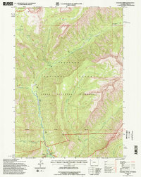
1991 Map of Pahaska Tepee
USGS Topo · Published 1997About this map
Pahaska Tepee serves as a central landmark at the gateway to Yellowstone National Park in this 1991 revision. The landscape is defined by the high-altitude drainage of the North Fork Shoshone River, where historical interest centers on the Camp Monaco (Site) near the Shoshone River in the northeastern corner. This area, managed by the Shoshone National Forest, reflects a preserved wilderness state, with the North Absaroka Wilderness boundary cutting across the central terrain.
Find a feature on this map
24 named features on this map. Tap any name to fly to it.
Don’t see what you’re looking for? This feature index may not catch every label — zoom into the map to look around manually.
Map Details
Editions of this 1991 Pahaska Tepee Map
2 editions found
Other maps of this area

1885 · Lake
USGS Topo · 1:125,000

1886 · Canyon
USGS Topo · 1:125,000

1893 · Ishawooa
USGS Topo · 1:125,000

1895 · Ishawooa
USGS Topo · 1:125,000

1895 · Canyon
USGS Topo · 1:125,000

1895 · Lake
USGS Topo · 1:125,000

1896 · Lake
USGS Topo · 1:125,000

1896 · Canyon
USGS Topo · 1:125,000

1896 · Crandall Creek
USGS Topo · 1:125,000

1899 · Crandall
USGS Topo · 1:125,000