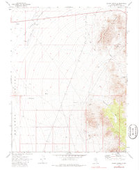
1970 Map of Pahroc Spring SE
USGS Topo · Published 1986About this map
Delamar Landing Field anchors the northwest portion of this 1970 landscape, situated within the flat expanse of the Dry Lake Valley (Depression). The terrain is defined by its arid hydrology, featuring a large Dry Lake bed and several isolated water sources such as Grassy Spring and Seven Oaks Spring. An Aqueduct cuts through the southern sections, indicating the critical management of water in this desert environment.
Find a feature on this map
17 named features on this map. Tap any name to fly to it.
Don’t see what you’re looking for? This feature index may not catch every label — zoom into the map to look around manually.
Map Details
Editions of this 1970 Pahroc Spring SE Map
2 editions found
Other maps of this area

1885 · Pioche
USGS Topo · 1:250,000

1886 · Pioche
USGS Topo · 1:250,000

1954 · Caliente
USGS Topo · 1:250,000

1959 · Caliente
USGS Topo · 1:250,000

1969 · Delamar
USGS Topo · 1:24,000

1969 · Slidy Mountain
USGS Topo · 1:24,000

1969 · Delamar NW
USGS Topo · 1:24,000
1970 · Pahroc Summit Pass
USGS Topo · 1:24,000
1970 · Pahroc Spring SE
USGS Topo · 1:24,000
1970 · Pahroc Spring NE
USGS Topo · 1:24,000