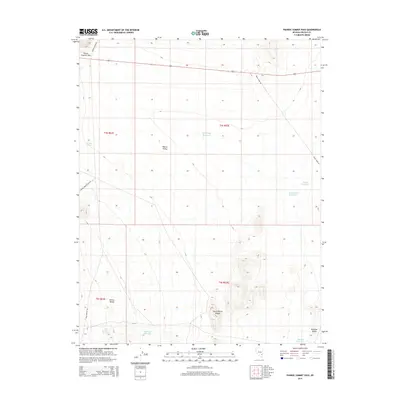
2014 Map of Pahroc Summit Pass
USGS Topo · Published 2014About this map
Pahroc Summit Pass serves as a critical navigation point through the high desert terrain of eastern Nevada, where the landscape transitions between the Pahroc Range and the South Pahroc Range. This 2014 survey reveals a network of water management features essential for life and industry in the arid Pahroc Valley. Reservoirs such as White Sage Reservoir, Southside Reservoir, and MacKay Reservoir are distributed across the valley floor and its margins, suggesting a reliance on seasonal runoff collection.
Find a feature on this map
21 named features on this map. Tap any name to fly to it.
Don’t see what you’re looking for? This feature index may not catch every label — zoom into the map to look around manually.
Map Details
Editions of this 2014 Pahroc Summit Pass Map
This is the sole edition of this map. No revisions or reprints were ever made.
Other maps of this area

1885 · Pioche
USGS Topo · 1:250,000

1886 · Pioche
USGS Topo · 1:250,000

1945 · Alamo
USGS Topo · 1:125,000

1954 · Caliente
USGS Topo · 1:250,000

1959 · Caliente
USGS Topo · 1:250,000

1969 · Delamar
USGS Topo · 1:24,000

1969 · Alamo NE
USGS Topo · 1:24,000

1969 · Delamar NW
USGS Topo · 1:24,000

1970 · Hiko NE
USGS Topo · 1:24,000
1970 · Pahroc Summit Pass
USGS Topo · 1:24,000