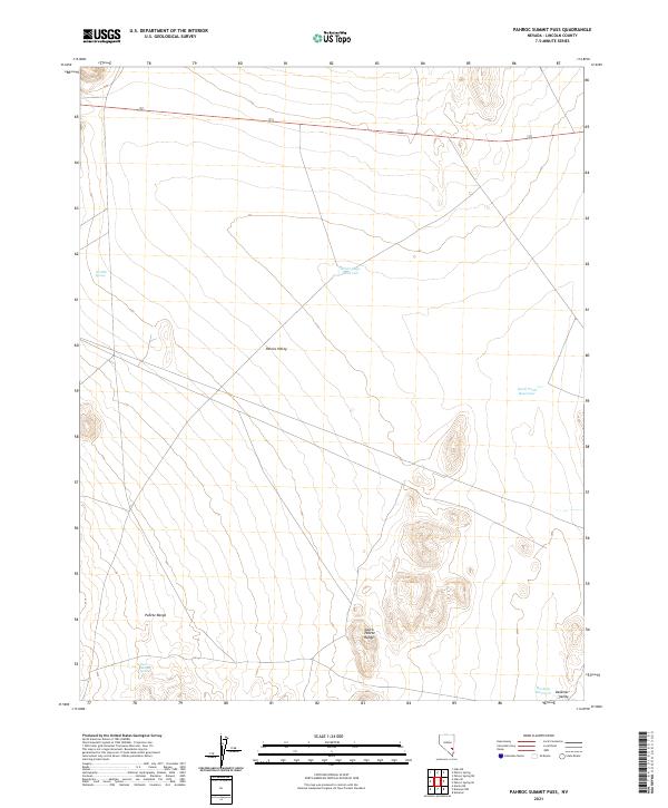
2021 Map of Pahroc Summit Pass
USGS Topo · Published 2021About this map
The high desert landscape of Lincoln County unfolds across this 2021 survey, centered on the broad expanse of Pahroc Valley and its surrounding mountain ranges. The northern portion of the Pahroc Range and the South Pahroc Range dominate the topography, providing a dramatic backdrop to the arid plains. Water resources in this environment are sparse and highly engineered, with livestock or irrigation-focused features like White-Sage Reservoir, Knoll Pond Reservoir, and Mackay Reservoir positioned to collect seasonal runoff. Natural water sources are limited to small, discrete points such as Six Mile Spring and East Boulder Spring. The map documents a mostly unpopulated terrain where the primary human footprint is found in the scattered reservoirs and the corridor of Route 93, which cuts through the northern sections of Delamar Valley.
Find a feature on this map
14 named features on this map. Tap any name to fly to it.
Don’t see what you’re looking for? This feature index may not catch every label — zoom into the map to look around manually.
Map Details
Editions of this 2021 Pahroc Summit Pass Map
This is the sole edition of this map. No revisions or reprints were ever made.
Other maps of this area

1885 · Pioche
USGS Topo · 1:250,000

1886 · Pioche
USGS Topo · 1:250,000

1945 · Alamo
USGS Topo · 1:125,000

1954 · Caliente
USGS Topo · 1:250,000

1959 · Caliente
USGS Topo · 1:250,000

1969 · Delamar
USGS Topo · 1:24,000

1969 · Alamo NE
USGS Topo · 1:24,000

1969 · Delamar NW
USGS Topo · 1:24,000

1970 · Hiko NE
USGS Topo · 1:24,000
1970 · Pahroc Summit Pass
USGS Topo · 1:24,000