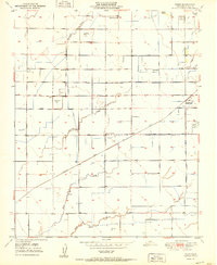
1951 Map of Paige
USGS Topo · Published 1951About this map
Paige and the surrounding agricultural landscape of Tulare County are defined by an intricate network of water management and rail transportation in the early 1950s. The Atchison Topeka and Santa Fe railroad bisects the terrain, serving as a primary corridor for the movement of goods and people. This grid-based development is punctuated by rural landmarks, including the Buena Vista Sch, Linder Sch, Laurel Sch, and Walnut Grove Sch, which illustrate the distributed nature of the community before the era of school consolidation.
Find a feature on this map
42 named features on this map. Tap any name to fly to it.
Don’t see what you’re looking for? This feature index may not catch every label — zoom into the map to look around manually.
Map Details
Editions of this 1951 Paige Map
This is the sole edition of this map. No revisions or reprints were ever made.
Other maps of this area

1925 · Tulare
USGS Topo · 1:31,680

1925 · Tipton
USGS Topo · 1:31,680

1926 · Goshen
USGS Topo · 1:31,680

1927 · Remnoy
USGS Topo · 1:31,680

1927 · Lake View School
USGS Topo · 1:31,680

1927 · Paige
USGS Topo · 1:31,680

1927 · Visalia
USGS Topo · 1:31,680

1927 · Tulare
USGS Topo · 1:31,680

1928 · Tipton
USGS Topo · 1:31,680

1928 · Waukena
USGS Topo · 1:31,680