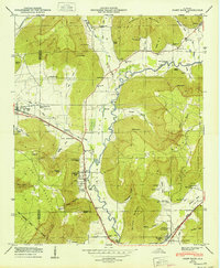
1950 Map of Paint Rock
USGS Topo · Published 1950About this map
Paint Rock River winds through the heart of this valley landscape, defining the local geography as it flows past Paint Rock and Garth. The area is characterized by a series of significant mountain landforms, including Keel Mountain and Bingham Mountain, which are cut by numerous hollows and coves. The Southern Railway runs parallel to the Lee Highway, providing a vital transportation corridor connecting the communities of Gurley and Woodville.
Find a feature on this map
74 named features on this map. Tap any name to fly to it.
Don’t see what you’re looking for? This feature index may not catch every label — zoom into the map to look around manually.
Map Details
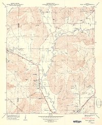
Editions of this 1950 Paint Rock Map
2 editions found
Other maps of this area

1888 · Scottsboro
USGS Topo · 1:125,000

1892 · Scottsboro
USGS Topo · 1:125,000

1936 · New Hope
USGS Topo · 1:24,000

1936 · Moontown
USGS Topo · 1:24,000

1936 · Hollytree
USGS Topo · 1:24,000

1936 · Grant
USGS Topo · 1:24,000

1936 · Princeton
USGS Topo · 1:24,000

1936 · Lim Rock
USGS Topo · 1:24,000

1936 · Maysville
USGS Topo · 1:24,000
1936 · Swearengin
USGS Topo · 1:24,000