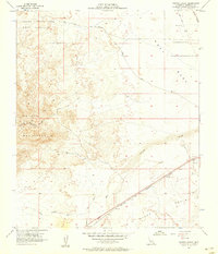
1957 Map of Painted Gorge
USGS Topo · Published 1958About this map
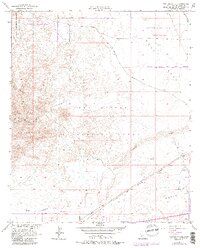
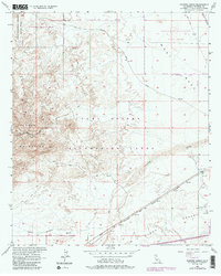
The Overland Stage Route cuts diagonally across the arid flats of the West Mesa, marking a historic transportation corridor through the Imperial Valley as it appeared in the late 1950s. To the west, the complex topography of the Coyote Mountains rises abruptly, featuring the namesake Painted Gorge and a network of jeep trails winding through the desert canyons. The landscape transitions from these peaks down into the Yuha Desert and along the broad, sandy expanse of Coyote Wash. Commercial activity and military utility are evident through the presence of several Gravel Pits and the expansive Carrizo Impact Area Naval Reservation occupying the northern reaches of the quadrangle. The southern edge is defined by the critical transit line of the San Diego and Arizona Eastern railroad, which parallels the path of Palm Canyon Wash.
Find a feature on this map
13 named features on this map. Tap any name to fly to it.
Don’t see what you’re looking for? This feature index may not catch every label — zoom into the map to look around manually.
Map Details
Editions of this 1957 Painted Gorge Map
6 editions found
Other maps of this area

1915 · El Centro
USGS Topo · 1:125,000

1931 · Carrizo
USGS Topo · 1:125,000

1939 · Jacumba
USGS Topo · 1:62,500

1940 · Plaster City
USGS Topo · 1:62,500

1940 · Coyote Wells
USGS Topo · 1:62,500

1942 · El Centro
USGS Topo · 1:250,000

1942 · Carrizo Mtn
USGS Topo · 1:62,500

1942 · Jacumba
USGS Topo · 1:62,500

1943 · Coyote Wells
USGS Topo · 1:62,500

1944 · Plaster City
USGS Topo · 1:62,500