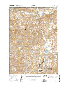
2014 Map of Painted Hills
USGS Topo · Published 2014About this map
The John Day Fossil Beds National Monument dominates the southeastern portion of this terrain, showcasing the geological formations of the Painted Hills. This landscape is defined by the erosion of volcanic ash layers, where landforms like Rainbow Hill, Carroll Rim, and Brown Grotto reveal the deep history of the region. The John Day River winds through the northern sections, joined by tributaries such as Bridge Cr and Bear Cr, which have carved numerous canyons including Lockwood Canyon and Shaw Canyon.
Find a feature on this map
29 named features on this map. Tap any name to fly to it.
Don’t see what you’re looking for? This feature index may not catch every label — zoom into the map to look around manually.
Map Details
Editions of this 2014 Painted Hills Map
This is the sole edition of this map. No revisions or reprints were ever made.
Other maps of this area

1926 · Mitchell
USGS Topo · 1:125,000

1955 · Bend
USGS Topo · 1:250,000

1957 · Bend
USGS Topo · 1:250,000

1958 · Bend
USGS Topo · 1:250,000

1966 · Mitchell
USGS Topo · 1:62,500

1966 · Kinzua
USGS Topo · 1:62,500

1966 · Clarno
USGS Topo · 1:62,500

1968 · Painted Hills
USGS Topo · 1:24,000

1968 · Lawson Mtn
USGS Topo · 1:24,000

1968 · Stephenson Mtn
USGS Topo · 1:24,000