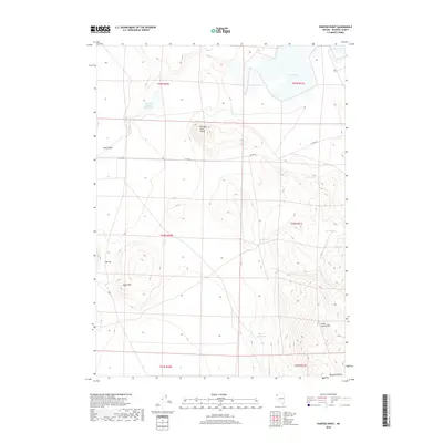
2018 Map of Painted Point
USGS Topo · Published 2018About this map
Captain Johnson Reservoir sits at the northern edge of this high-desert landscape in northwestern Washoe County, a region defined by scattered water sources and isolated mountain ranges. The terrain transitions from the wide floor of Long Valley through the elevations of the Painted Point Range to the southern Massacre Range. This 2018 survey reveals a sparse network of backroads, primarily Co Rte 8a, which connects vital desert waypoints. Notable for its many natural water features, the map tracks Massacre Lake and West Lake in the northeast, alongside essential springs such as Sand Spring, Twin Springs, and Lone Spring. These locations represent the historical lifelines for ranching and transit through this arid corner of Nevada, where landmarks like the Black Hills and Lone Spring Mtn provided critical orientation across the open range.
Find a feature on this map
19 named features on this map. Tap any name to fly to it.
Don’t see what you’re looking for? This feature index may not catch every label — zoom into the map to look around manually.
Map Details
Editions of this 2018 Painted Point Map
This is the sole edition of this map. No revisions or reprints were ever made.
Other maps of this area

1889 · Long Valley
USGS Topo · 1:250,000

1954 · Vya
USGS Topo · 1:250,000

1958 · Vya
USGS Topo · 1:250,000

1962 · Vya
USGS Topo · 1:250,000

1966 · Massacre Lake NW
USGS Topo · 1:24,000

1966 · Vya
USGS Topo · 1:24,000

1966 · Massacre Lake
USGS Topo · 1:24,000

1966 · Alkali Lake
USGS Topo · 1:24,000

1966 · Massacre Creek
USGS Topo · 1:24,000

1966 · Painted Point
USGS Topo · 1:24,000