
1960 Map of Painted Rocks Lake
USGS Topo · Published 1961About this map
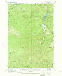
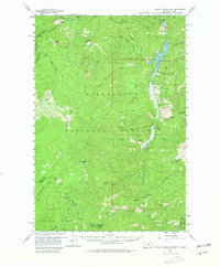
Alta sits along the West Fork Bitterroot River, serving as a focal point for this high-altitude region of the Bitterroot National Forest during the early 1960s. The landscape is defined by the massive impoundment of Painted Rocks Lake, showing a spillway elevation of 4,726 feet and various creeks like Little Boulder Creek and Blue Joint Creek feeding the reservoir. Transportation through these mountains relies on historic paths such as the Nez Perce Trail and the Castle Route, which navigate the steep terrain between peaks like Razorback Mountain and Bare Cone. The map documents the resource-extraction history of the area, notably the Copper Queen Mine located near Beaver Pt, and various remote outposts including the Magruder Ranger Sta and the Ranger Station at Alta. The boundary between Montana and Idaho follows the high ridges, separating the Salmon National Forest from the Bitterroot range.
Find a feature on this map
48 named features on this map. Tap any name to fly to it.
Don’t see what you’re looking for? This feature index may not catch every label — zoom into the map to look around manually.
Map Details
Editions of this 1960 Painted Rocks Lake Map
3 editions found
Other maps of this area

1956 · Elk City
USGS Topo · 1:250,000

1960 · Elk City
USGS Topo · 1:250,000

1960 · Ulysses Mtn
USGS Topo · 1:62,500

1960 · Shoup
USGS Topo · 1:62,500

1960 · Piquett Mountain
USGS Topo · 1:62,500

1962 · Blue Joint
USGS Topo · 1:24,000

1962 · Horse Creek Butte
USGS Topo · 1:24,000

1962 · Nez Perce Peak
USGS Topo · 1:24,000

1964 · Boulder Peak
USGS Topo · 1:24,000
1964 · Mount Jerusalem
USGS Topo · 1:24,000