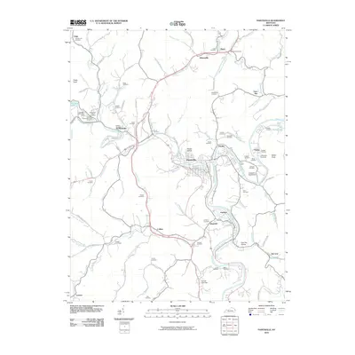
2010 Map of Paintsville
USGS Topo · Published 2010About this map
Paintsville serves as the central hub of this eastern Kentucky valley, where the waters of Paint Creek meet the winding Levisa Fork. The town's layout reflects a landscape deeply shaped by its waterways and gaps, such as the notably named Cannel Coal Gap to the south. This 2010 survey captures a region where family history is etched into the terrain, evidenced by the dense distribution of family burial grounds like the Whitehouse Cemetery, Vanhoose Cemetery, and Goble Cemetery. These sites, often perched on the ridges and knobs surrounding the valley floor, offer a window into the genealogical legacy of Johnson County.
Find a feature on this map
111 named features on this map. Tap any name to fly to it.
Don’t see what you’re looking for? This feature index may not catch every label — zoom into the map to look around manually.
Map Details
Editions of this 2010 Paintsville Map
This is the sole edition of this map. No revisions or reprints were ever made.
Other maps of this area

1886 · Prestonsburg
USGS Topo · 1:125,000

1892 · Prestonsburg
USGS Topo · 1:125,000

1914 · Laynesville
USGS Topo · 1:48,000

1914 · Inez
USGS Topo · 1:48,000

1915 · Paintsville
USGS Topo · 1:48,000

1915 · Prestonsburg
USGS Topo · 1:62,500

1916 · Harold
USGS Topo · 1:62,500

1916 · Inez
USGS Topo · 1:62,500

1917 · Paintsville
USGS Topo · 1:62,500

1918 · Prestonsburg
USGS Topo · 1:62,500