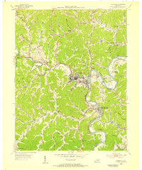
1954 Map of Paintsville
USGS Topo · Published 1955About this map
Paintsville serves as the focal point of this mid-century Appalachian landscape, situated where Paint Creek joins the winding Levisa Fork. The survey reveals a region deeply shaped by its industrial and topographic character, dominated by the Chesapeake and Ohio railroad corridor that connects the commercial center to outlying mining and rail settlements like Van Lear and West Van Lear. Extensive extraction activity is evident through the numerous gas and oil wells dotting the ridges and hollows, while the social fabric of these small communities is marked by a dense network of local institutions, including Union Church and Hager Hill School. Notable geographic features like Canal Coal Gap and Bettys Knob punctuate the heavily dissected terrain, illustrating the constraints and pathways that guided development in Johnson County during the 1950s.
Find a feature on this map
85 named features on this map. Tap any name to fly to it.
Don’t see what you’re looking for? This feature index may not catch every label — zoom into the map to look around manually.
Map Details
Editions of this 1954 Paintsville Map
This is the sole edition of this map. No revisions or reprints were ever made.
Other maps of this area

1886 · Prestonsburg
USGS Topo · 1:125,000

1892 · Prestonsburg
USGS Topo · 1:125,000

1914 · Laynesville
USGS Topo · 1:48,000

1914 · Inez
USGS Topo · 1:48,000

1915 · Paintsville
USGS Topo · 1:48,000

1915 · Prestonsburg
USGS Topo · 1:62,500

1916 · Harold
USGS Topo · 1:62,500

1916 · Inez
USGS Topo · 1:62,500

1917 · Paintsville
USGS Topo · 1:62,500

1918 · Prestonsburg
USGS Topo · 1:62,500