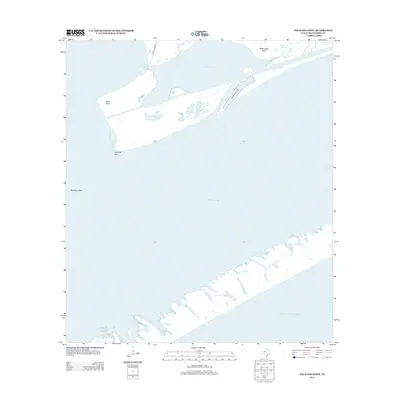
2013 Map of Palacios Point
USGS Topo · Published 2013About this map
Matagorda Bay dominates this coastal survey, where the convergence of several major bayous and protected lakes creates a complex estuarine environment. The landscape is defined by its prominent landmarks like Palacios Point and Hotel Point, which flank the entrance to Palacios Bayou. These points of land, along with Rattlesnake Point near Oyster Lake, serve as critical navigational markers for the region's marine traffic.
Find a feature on this map
13 named features on this map. Tap any name to fly to it.
Don’t see what you’re looking for? This feature index may not catch every label — zoom into the map to look around manually.
Map Details
Editions of this 2013 Palacios Point Map
This is the sole edition of this map. No revisions or reprints were ever made.
Other maps of this area

1952 · Palacios SE
USGS Topo · 1:24,000

1952 · Palacios Point
USGS Topo · 1:24,000

1952 · Palacios
USGS Topo · 1:24,000

1952 · Turtle Bay
USGS Topo · 1:24,000

1952 · South of Palacios Point
USGS Topo · 1:24,000

1952 · Palacios NE
USGS Topo · 1:24,000

1952 · Decros Point
USGS Topo · 1:24,000

1953 · Beeville
USGS Topo · 1:250,000

1956 · Beeville
USGS Topo · 1:250,000

1960 · Beeville
USGS Topo · 1:250,000