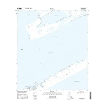
2016 Map of Palacios Point
USGS Topo · Published 2016About this map
Palacios Point and the surrounding coastal waters of the Gulf of Mexico dominate this 2016 survey, where the terrestrial landscape is defined by the thin, protective strip of the Matagorda Peninsula. This environment is a complex intersection of open water and tidal marshland, marked by numerous coastal inlets including Phillips Bayou, Cotton Bayou, and Hillebrandt Bayou. The area serves as a critical maritime corridor, with the Intracoastal Waterway cutting through the center of Matagorda Bay, facilitating commercial navigation behind the barrier islands.
Find a feature on this map
14 named features on this map. Tap any name to fly to it.
Don’t see what you’re looking for? This feature index may not catch every label — zoom into the map to look around manually.
Map Details
Editions of this 2016 Palacios Point Map
This is the sole edition of this map. No revisions or reprints were ever made.
Other maps of this area

1952 · Palacios SE
USGS Topo · 1:24,000

1952 · Palacios Point
USGS Topo · 1:24,000

1952 · Palacios
USGS Topo · 1:24,000

1952 · Turtle Bay
USGS Topo · 1:24,000

1952 · South of Palacios Point
USGS Topo · 1:24,000

1952 · Palacios NE
USGS Topo · 1:24,000

1952 · Decros Point
USGS Topo · 1:24,000

1953 · Beeville
USGS Topo · 1:250,000

1956 · Beeville
USGS Topo · 1:250,000

1960 · Beeville
USGS Topo · 1:250,000