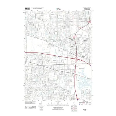
2012 Map of Palatine
USGS Topo · Published 2012About this map
Schaumburg and Hoffman Estates anchor this densely developed corridor of suburban Cook County, where the transition from post-war residential growth to modern commercial infrastructure is clearly evident. The landscape is defined by its extensive network of water management and recreation, featuring the large Busse Lake and its surrounding Busse Forest Nature Preserve, alongside numerous smaller bodies like Peregrine Lake and Volkening Lake. These features, carved into the watersheds of Salt Creek and its west branch, provide a counterpoint to the commercial intensity of the William Rainey Harper College campus.
Find a feature on this map
49 named features on this map. Tap any name to fly to it.
Don’t see what you’re looking for? This feature index may not catch every label — zoom into the map to look around manually.
Map Details
Editions of this 2012 Palatine Map
This is the sole edition of this map. No revisions or reprints were ever made.
Other maps of this area

1891 · Riverside
USGS Topo · 1:62,500

1893 · Riverside
USGS Topo · 1:62,500

1900 · Riverside
USGS Topo · 1:62,500

1900 · Highwood
USGS Topo · 1:62,500

1901 · Riverside
USGS Topo · 1:62,500

1908 · Wheaton
USGS Topo · 1:62,500

1923 · Barrington
USGS Topo · 1:62,500

1927 · Arlington Heights
USGS Topo · 1:24,000

1928 · Elmhurst
USGS Topo · 1:24,000

1928 · Wheeling
USGS Topo · 1:24,000