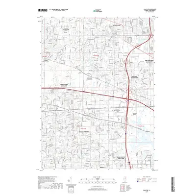
2018 Map of Palatine
USGS Topo · Published 2018About this map
Schaumburg and its surrounding suburbs appear as a dense network of residential streets and commercial corridors in this detailed 2018 survey. The landscape is defined by the winding paths of Salt Cr and its branches, alongside numerous man-made water features like North Pool and S Pool within the Ned Brown Meadow area. The presence of significant institutional sites such as Harper College and large-scale cemeteries, including the Saint Michael the Archangel Catholic Cem and Mausoleum, underscores the mature suburban development of northwest Cook County. Connectivity is provided by major thoroughfares like W Palatine Rd and the Metra rail line, which link older centers like Palatine and Arlington Heights with modern estates in Hoffman Estates and Inverness.
Find a feature on this map
55 named features on this map. Tap any name to fly to it.
Don’t see what you’re looking for? This feature index may not catch every label — zoom into the map to look around manually.
Map Details
Editions of this 2018 Palatine Map
This is the sole edition of this map. No revisions or reprints were ever made.
Other maps of this area

1891 · Riverside
USGS Topo · 1:62,500

1893 · Riverside
USGS Topo · 1:62,500

1900 · Riverside
USGS Topo · 1:62,500

1900 · Highwood
USGS Topo · 1:62,500

1901 · Riverside
USGS Topo · 1:62,500

1908 · Wheaton
USGS Topo · 1:62,500

1923 · Barrington
USGS Topo · 1:62,500

1927 · Arlington Heights
USGS Topo · 1:24,000

1928 · Elmhurst
USGS Topo · 1:24,000

1928 · Wheeling
USGS Topo · 1:24,000