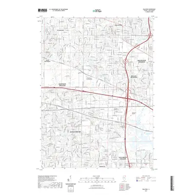
2021 Map of Palatine
USGS Topo · Published 2021About this map
Palatine and its neighboring Cook County suburbs appear here in a highly developed 21st-century landscape, dominated by a dense grid of residential and commercial thoroughfares. The southern portion of the village transitions into the sprawling Hoffman Estates, while the western edge reaches the wooded borders of Inverness. This modern survey illustrates the significant preservation of community memory through numerous historic burial grounds, including the Hillside Cem, Union Cem, and the expansive Saint Michael the Archangel Catholic Cem and Mausoleum.
Find a feature on this map
49 named features on this map. Tap any name to fly to it.
Don’t see what you’re looking for? This feature index may not catch every label — zoom into the map to look around manually.
Map Details
Editions of this 2021 Palatine Map
This is the sole edition of this map. No revisions or reprints were ever made.
Other maps of this area

1891 · Riverside
USGS Topo · 1:62,500

1893 · Riverside
USGS Topo · 1:62,500

1900 · Riverside
USGS Topo · 1:62,500

1900 · Highwood
USGS Topo · 1:62,500

1901 · Riverside
USGS Topo · 1:62,500

1908 · Wheaton
USGS Topo · 1:62,500

1923 · Barrington
USGS Topo · 1:62,500

1927 · Arlington Heights
USGS Topo · 1:24,000

1928 · Elmhurst
USGS Topo · 1:24,000

1928 · Wheeling
USGS Topo · 1:24,000