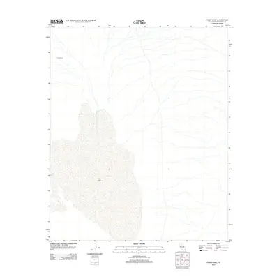
2012 Map of Palen Lake
USGS Topo · Published 2012About this map
Palen Lake dominates the central and southern portions of this arid landscape, appearing here as an expansive dry lake bed in the California desert. The terrain is characterized by a complex network of ephemeral washes and alluvial fans that drain toward the lake from the surrounding highlands. Human presence is sparse, represented primarily by Circle E Ranch in the northwest corner, illustrating the isolated nature of ranching and land use in this part of Riverside County. This 2012 survey captures a environment where the subtle movements of water and historical land divisions create a unique topographical record of the Mojave or Colorado desert regions. The map provides a detailed view of the natural drainage patterns that define the basin, offering a precise look at the landforms as they existed in the early 21st century.
Find a feature on this map
2 named features on this map. Tap any name to fly to it.
Don’t see what you’re looking for? This feature index may not catch every label — zoom into the map to look around manually.
Map Details
Editions of this 2012 Palen Lake Map
This is the sole edition of this map. No revisions or reprints were ever made.
Other maps of this area

1943 · Coxcomb Mountains
USGS Topo · 1:62,500

1944 · Chuckwalla Mountains
USGS Topo · 1:62,500

1944 · Coxcomb Mountains
USGS Topo · 1:62,500

1952 · Sidewinder Well
USGS Topo · 1:62,500

1952 · Palen Mountains
USGS Topo · 1:62,500

1954 · Salton Sea
USGS Topo · 1:250,000

1955 · Salton Sea
USGS Topo · 1:250,000

1959 · Salton Sea
USGS Topo · 1:250,000

1963 · Salton Sea
USGS Topo · 1:250,000

1963 · Chuckwalla Mountains
USGS Topo · 1:62,500