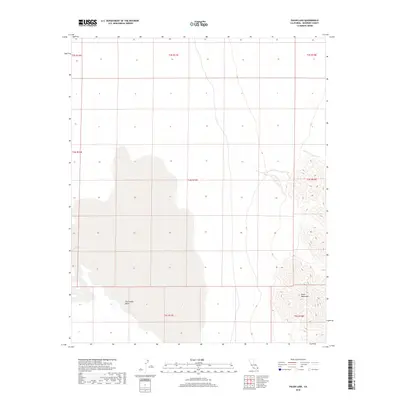
2018 Map of Palen Lake
USGS Topo · Published 2018About this map
Chuckwalla Valley dominates the central and western landscape of this 2018 survey, appearing as a broad alluvial expanse in the Colorado Desert of Riverside County. The eastern edge of the quadrangle is defined by the sharp rise of the Palen Mountains, where steep contour lines reveal a stark contrast to the low-lying valley floor. This desert environment is characterized by large, unpopulated sections of land, delineated by the Public Land Survey System grids including t4s-r17e- and t5s r18e. The cartography highlights the natural drainage patterns and topographical transitions of the region, illustrating the arid isolation and specialized terrain of this portion of California's interior desert.
Find a feature on this map
10 named features on this map. Tap any name to fly to it.
Don’t see what you’re looking for? This feature index may not catch every label — zoom into the map to look around manually.
Map Details
Editions of this 2018 Palen Lake Map
This is the sole edition of this map. No revisions or reprints were ever made.
Other maps of this area

1943 · Coxcomb Mountains
USGS Topo · 1:62,500

1944 · Chuckwalla Mountains
USGS Topo · 1:62,500

1944 · Coxcomb Mountains
USGS Topo · 1:62,500

1952 · Sidewinder Well
USGS Topo · 1:62,500

1952 · Palen Mountains
USGS Topo · 1:62,500

1954 · Salton Sea
USGS Topo · 1:250,000

1955 · Salton Sea
USGS Topo · 1:250,000

1959 · Salton Sea
USGS Topo · 1:250,000

1963 · Salton Sea
USGS Topo · 1:250,000

1963 · Chuckwalla Mountains
USGS Topo · 1:62,500