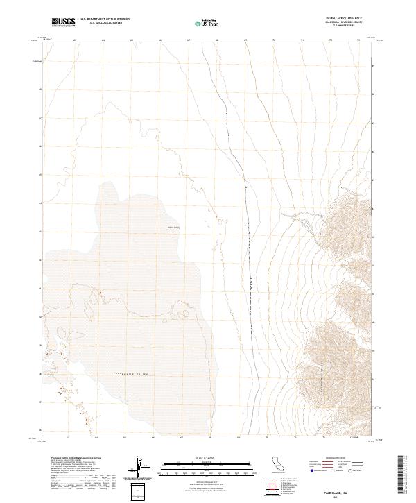
2021 Map of Palen Lake
USGS Topo · Published 2021About this map
Palen Valley dominates this desert landscape in eastern Riverside County, where the dry lakebed environment meets the rising slopes of the Palen Mountains. The map illustrates the convergence of two major desert basins, as the valley floor transitions southward into the Chuckwalla Valley. This area is defined by its arid character and lacks the permanent settlements or developed roads seen in more populous regions of the state. Instead, the survey provides a precise look at the township and range lines across the T3S, T4S, and T5S boundaries, which are essential for locating historical mining claims or land allotments in this part of the Mojave Desert. The intricate contour lines along the eastern edge of the sheet reveal the complex topography of the mountain range that flanks the valley.
Find a feature on this map
11 named features on this map. Tap any name to fly to it.
Don’t see what you’re looking for? This feature index may not catch every label — zoom into the map to look around manually.
Map Details
Editions of this 2021 Palen Lake Map
This is the sole edition of this map. No revisions or reprints were ever made.
Other maps of this area

1943 · Coxcomb Mountains
USGS Topo · 1:62,500

1944 · Chuckwalla Mountains
USGS Topo · 1:62,500

1944 · Coxcomb Mountains
USGS Topo · 1:62,500

1952 · Sidewinder Well
USGS Topo · 1:62,500

1952 · Palen Mountains
USGS Topo · 1:62,500

1954 · Salton Sea
USGS Topo · 1:250,000

1955 · Salton Sea
USGS Topo · 1:250,000

1959 · Salton Sea
USGS Topo · 1:250,000

1963 · Salton Sea
USGS Topo · 1:250,000

1963 · Chuckwalla Mountains
USGS Topo · 1:62,500