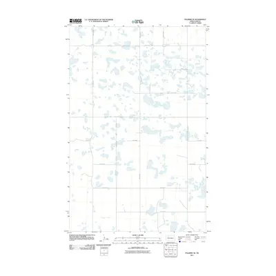
2011 Map of Palermo NE
USGS Topo · Published 2011About this map
Glacial prairie potholes and seasonal wetlands dominate this corner of Mountrail County in the early twenty-first century. The landscape is defined by a strict section-line grid of rural roads, including 74th St NW and 66th Ave NW, which carve through a terrain dotted with hundreds of small water bodies. This pattern reflects the enduring legacy of the Public Land Survey System, where agriculture and infrastructure adapt to the natural drainage of the Missouri Coteau region. The density of these depressions suggests a land primarily used for grazing or left in its natural state, as the roads like 70th St NW and 62nd Ave NW navigate around the larger basins. This map provides a detailed view of the rural township structure before more intensive modern development altered the classic North Dakota prairie character.
Find a feature on this map
12 named features on this map. Tap any name to fly to it.
Don’t see what you’re looking for? This feature index may not catch every label — zoom into the map to look around manually.
Map Details
Editions of this 2011 Palermo NE Map
This is the sole edition of this map. No revisions or reprints were ever made.
Other maps of this area

1947 · Tolley
USGS Topo · 1:62,500

1948 · Donnybrook
USGS Topo · 1:24,000

1949 · Mosquito Butte
USGS Topo · 1:24,000

1949 · Coulee
USGS Topo · 1:24,000

1950 · Kenmare
USGS Topo · 1:62,500

1950 · Tolley
USGS Topo · 1:62,500

1953 · Williston
USGS Topo · 1:250,000

1954 · Minot
USGS Topo · 1:250,000

1957 · Williston
USGS Topo · 1:250,000

1958 · Minot
USGS Topo · 1:250,000