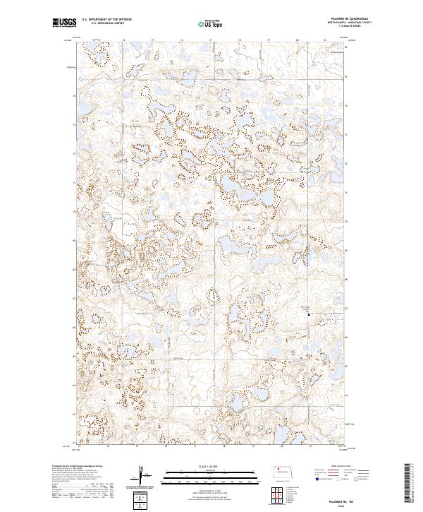
2024 Map of Palermo NE
USGS Topo · Published 2024About this map
Mountrail County Waterfowl Production Area dominates much of this Northern Plains landscape, characterized by numerous small wetlands and glacial potholes. This prairie pothole region in North Dakota is defined by its drainage patterns, notably Berg Coulee in the northeast corner. The map documents a sparsely settled agricultural and conservation-focused area within the townships of T158N R89W and T157N R88W. A central landmark for local family history is Saint Lukes Lutheran Cem located along 62nd Ave NW. The grid of section lines and gravel roads, including 74th St NW and 67th St NW, provides a detailed look at the rural infrastructure and land management typical of Mountrail County in the early 21st century.
Find a feature on this map
20 named features on this map. Tap any name to fly to it.
Don’t see what you’re looking for? This feature index may not catch every label — zoom into the map to look around manually.
Map Details
Editions of this 2024 Palermo NE Map
This is the sole edition of this map. No revisions or reprints were ever made.
Other maps of this area

1947 · Tolley
USGS Topo · 1:62,500

1948 · Donnybrook
USGS Topo · 1:24,000

1949 · Mosquito Butte
USGS Topo · 1:24,000

1949 · Coulee
USGS Topo · 1:24,000

1950 · Kenmare
USGS Topo · 1:62,500

1950 · Tolley
USGS Topo · 1:62,500

1953 · Williston
USGS Topo · 1:250,000

1954 · Minot
USGS Topo · 1:250,000

1957 · Williston
USGS Topo · 1:250,000

1958 · Minot
USGS Topo · 1:250,000