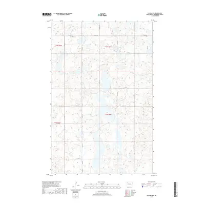
2017 Map of Palermo NW
USGS Topo · Published 2017About this map
The Zion Lutheran Cem stands as a focal point for family history in this corner of Mountrail County, set within a landscape defined by an intricate network of wetlands and small water bodies. The terrain is structured by a grid of rural roads, including 75th St Nw and 70th St Nw, which trace the section lines typical of the Public Land Survey System. A more descriptive path, the Prairie Trl, cuts through the southwestern portion of the map, suggesting a route that follows the natural contours of the land rather than the strict township grid. This map documents the persistent agricultural and ecological character of the High Plains in the early twenty-first century, where the arrangement of roads and the single church cemetery reflect a low-density settlement pattern that has changed little since the initial homesteading era.
Find a feature on this map
14 named features on this map. Tap any name to fly to it.
Don’t see what you’re looking for? This feature index may not catch every label — zoom into the map to look around manually.
Map Details
Editions of this 2017 Palermo NW Map
This is the sole edition of this map. No revisions or reprints were ever made.
Other maps of this area

1949 · Mosquito Butte
USGS Topo · 1:24,000

1949 · Coulee
USGS Topo · 1:24,000

1950 · Kenmare
USGS Topo · 1:62,500

1953 · Williston
USGS Topo · 1:250,000

1957 · Williston
USGS Topo · 1:250,000

1969 · Stanley SE
USGS Topo · 1:24,000

1978 · Westby Lake
USGS Topo · 1:24,000

1981 · Stanley SE
USGS Topo · 1:24,000
1981 · Palermo NE
USGS Topo · 1:24,000

1981 · Palermo
USGS Topo · 1:24,000