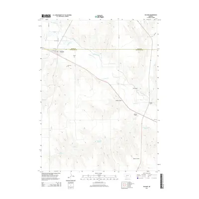
2014 Map of Palisade
USGS Topo · Published 2014About this map
Palisade sits at the intersection of Hayes and Hitchcock counties, serving as a focal point for this rural agricultural landscape. The village is flanked by significant local history sites, including both the Palisade Cem and the Old Palisade Cem. The region's water management is central to its identity, with the Culbertson Canal and Frenchman Cr carving paths through the terrain to support the surrounding farms.
Find a feature on this map
27 named features on this map. Tap any name to fly to it.
Don’t see what you’re looking for? This feature index may not catch every label — zoom into the map to look around manually.
Map Details
Editions of this 2014 Palisade Map
This is the sole edition of this map. No revisions or reprints were ever made.
Other maps of this area

1954 · McCook
USGS Topo · 1:250,000

1957 · McCook
USGS Topo · 1:250,000

1958 · McCook
USGS Topo · 1:250,000

1962 · Trenton
USGS Topo · 1:24,000

1962 · Culbertson NW
USGS Topo · 1:24,000

1962 · Stratton
USGS Topo · 1:24,000

1973 · Palisade
USGS Topo · 1:24,000
1973 · Beverly
USGS Topo · 1:24,000

1973 · Palisade SW
USGS Topo · 1:24,000
1973 · Burger Canyon West
USGS Topo · 1:24,000