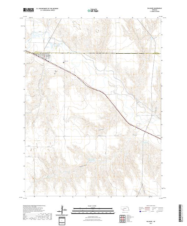
2021 Map of Palisade
USGS Topo · Published 2021About this map
Palisade serves as the primary hub of this landscape at the boundary of Hayes and Hitchcock counties, situated where the valley meets the surrounding canyon lands. The town's local history is anchored by the Old Palisade Cem and the newer Palisade Cem, while the Burlington Northern Santa Fe railway cuts a diagonal path through the township, reflecting the area's continued reliance on rail transportation.
Find a feature on this map
35 named features on this map. Tap any name to fly to it.
Don’t see what you’re looking for? This feature index may not catch every label — zoom into the map to look around manually.
Map Details
Editions of this 2021 Palisade Map
This is the sole edition of this map. No revisions or reprints were ever made.
Other maps of this area

1954 · McCook
USGS Topo · 1:250,000

1957 · McCook
USGS Topo · 1:250,000

1958 · McCook
USGS Topo · 1:250,000

1962 · Trenton
USGS Topo · 1:24,000

1962 · Culbertson NW
USGS Topo · 1:24,000

1962 · Stratton
USGS Topo · 1:24,000

1973 · Palisade
USGS Topo · 1:24,000
1973 · Beverly
USGS Topo · 1:24,000

1973 · Palisade SW
USGS Topo · 1:24,000
1973 · Burger Canyon West
USGS Topo · 1:24,000