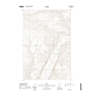
2020 Map of Palisades
USGS Topo · Published 2020About this map
Douglas Creek carves a deep path through this portion of the Columbia Plateau, defining the settlement patterns and road networks within the canyon floor. The community of Palisades serves as the primary focal point, situated at the confluence of several drainages where the water table supports local life in an otherwise arid landscape. High above the valley, the summit of Badger Mountain dominates the western horizon, overlooking a network of springs and intermittent streams.
Find a feature on this map
15 named features on this map. Tap any name to fly to it.
Don’t see what you’re looking for? This feature index may not catch every label — zoom into the map to look around manually.
Map Details
Editions of this 2020 Palisades Map
This is the sole edition of this map. No revisions or reprints were ever made.
Other maps of this area

1901 · Chelan
USGS Topo · 1:125,000

1912 · Malaga
USGS Topo · 1:48,000

1914 · Malaga
USGS Topo · 1:62,500

1920 · Colockum Pass
USGS Topo · 1:125,000

1922 · Colockum Pass
USGS Topo · 1:125,000

1953 · Ritzville
USGS Topo · 1:250,000

1957 · Wenatchee
USGS Topo · 1:250,000

1959 · Ritzville
USGS Topo · 1:250,000

1965 · Ritzville
USGS Topo · 1:250,000
1966 · Monument Hill
USGS Topo · 1:24,000