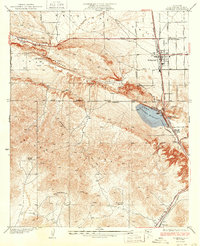
1937 Map of Palmdale
USGS Topo · Published 1937About this map
Antelope Valley and the surrounding high desert terrain are defined here by the distinct geological scar of the San Andreas Rift Valley. In the 1930s, this area served as a vital transportation corridor where the Southern Pacific railroad and the Sierra Highway run parallel through the narrow Soledad Pass. The settlement of Palmdale appears as a growing desert hub, supported by the critical infrastructure of the Aqueduct and Palmdale Reservoir. Local ranching life is well-documented through named properties such as City Ranch, Sunset Ranch, and Tuckerway Ranch, while small rail stops like Harold and Alpine mark the progress of the line toward the mountains. The landscape transitions sharply from the flat valley floor near Amargosa Creek into the steep, complex folds of the Sierra Pelona and Ritter Ridge.
Find a feature on this map
30 named features on this map. Tap any name to fly to it.
Don’t see what you’re looking for? This feature index may not catch every label — zoom into the map to look around manually.
Map Details
Editions of this 1937 Palmdale Map
4 editions found
Other maps of this area

1900 · Tujunga
USGS Topo · 1:62,500

1901 · Southern California Sheet No. 1
USGS Topo · 1:250,000

1904 · Southern California Sheet No. 1
USGS Topo · 1:250,000

1915 · Elizabeth Lake
USGS Topo · 1:125,000

1917 · Elizabeth Lake
USGS Topo · 1:125,000

1930 · Ravenna
USGS Topo · 1:24,000

1930 · Lancaster
USGS Topo · 1:24,000

1930 · Pearland
USGS Topo · 1:24,000

1930 · Tierra Bonita
USGS Topo · 1:24,000

1931 · Del Sur
USGS Topo · 1:24,000