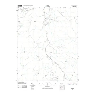
2010 Map of Palmer
USGS Topo · Published 2010About this map
Palmer and the nearby settlement of Gruetli-Laager occupy a landscape defined by the legacies of resource extraction in the South Cumberland region. The mining heritage is evident through features like Palmer Mine, Coal Valley Mine, and Reel Cove Mine, which are situated among the steep ridges and coves of the plateau. The complex topography includes notable natural landmarks such as Bearpen Gulf, Lenny Harris Cove, and Butterstack Ridge, while the headwaters of numerous streams like Mill Creek and Griffith Creek carve through the terrain.
Find a feature on this map
70 named features on this map. Tap any name to fly to it.
Don’t see what you’re looking for? This feature index may not catch every label — zoom into the map to look around manually.
Map Details
Editions of this 2010 Palmer Map
This is the sole edition of this map. No revisions or reprints were ever made.
Other maps of this area

1888 · Chattanooga
USGS Topo · 1:125,000

1893 · Chattanooga
USGS Topo · 1:125,000

1895 · Sewanee
USGS Topo · 1:125,000

1936 · Palmer
USGS Topo · 1:24,000

1936 · Daus
USGS Topo · 1:24,000

1936 · Whitwell
USGS Topo · 1:24,000

1936 · Tracy City
USGS Topo · 1:24,000

1936 · Ketner Gap
USGS Topo · 1:24,000

1936 · White City
USGS Topo · 1:24,000
1936 · Savage Point
USGS Topo · 1:24,000