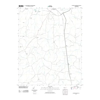
2010 Map of Palmer Shelter
USGS Topo · Published 2010About this map
Huntingdon and its southern agricultural hinterland define this Carroll County landscape, where the headwaters of numerous creeks begin their descent toward the West Tennessee lowlands. The rural character of the area is underscored by its network of named family cemeteries, including Liberty All Cemetery and Antioch Cemetery, which serve as vital markers for local genealogical research. Ernest Vickers Lake and its associated dam lie just north of the Huntingdon Airport, providing a distinct landmark in a region primarily shaped by the meandering paths of Brier Creek, Reedy Creek, and Beaver Creek. The terrain transitions from higher points like Slip Top and Marshall Hill into a complex system of branches and runs that historically dictated the placement of early settlements and road networks such as Old Stage Rd.
Find a feature on this map
75 named features on this map. Tap any name to fly to it.
Don’t see what you’re looking for? This feature index may not catch every label — zoom into the map to look around manually.
Map Details
Editions of this 2010 Palmer Shelter Map
This is the sole edition of this map. No revisions or reprints were ever made.
Other maps of this area

1936 · Clarksburg
USGS Topo · 1:24,000

1936 · Yuma
USGS Topo · 1:24,000

1936 · Vale
USGS Topo · 1:24,000

1936 · Center Ridge
USGS Topo · 1:24,000

1936 · Buena Vista
USGS Topo · 1:24,000

1950 · Yuma
USGS Topo · 1:24,000

1950 · Palmer Shelter
USGS Topo · 1:24,000

1950 · Vale
USGS Topo · 1:24,000
1950 · Buena Vista
USGS Topo · 1:24,000

1950 · Clarksburg
USGS Topo · 1:24,000