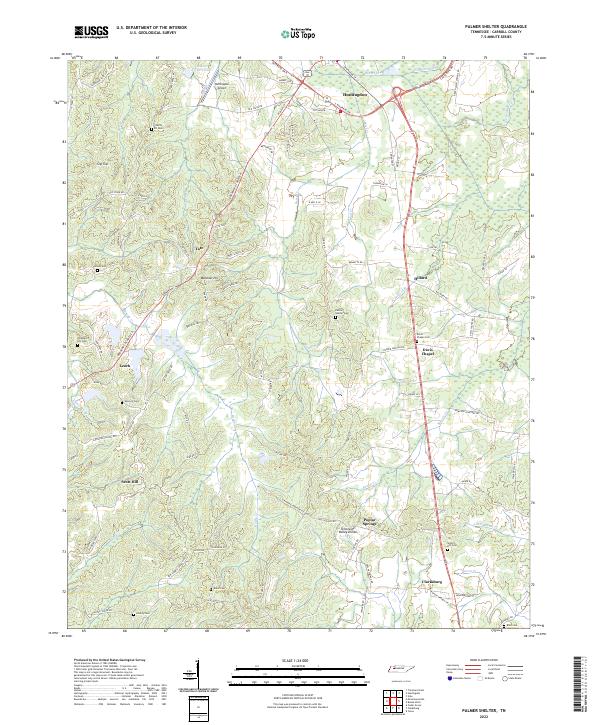
2022 Map of Palmer Shelter
USGS Topo · Published 2022About this map
Huntingdon and the surrounding Carroll County countryside are defined by a complex network of tributaries feeding into Beaver Cr and Reedy Cr. This landscape is marked by the Tennessee Valley Divide, where small settlements like Clarksburg, Leach, and Tate evolved along ridges and creek crossings. The map reveals a dense concentration of family and community burying grounds, including Palmer Shelter Cem, Antioch Cem, and Sellers Hill Cem, which serve as vital markers for local genealogical research. In the north, the Huntingdon Airport and Ernest Vickers Lake stand near the modern road network, while the southern reaches near Poplar Springs show the persistent rural character of the region. The numerous named branches, such as Butler Br and Northwood Br, illustrate the intricate drainage patterns that have historically influenced land use and farm placement throughout this Tennessee valley.
Find a feature on this map
103 named features on this map. Tap any name to fly to it.
Don’t see what you’re looking for? This feature index may not catch every label — zoom into the map to look around manually.
Map Details
Editions of this 2022 Palmer Shelter Map
This is the sole edition of this map. No revisions or reprints were ever made.
Other maps of this area

1936 · Clarksburg
USGS Topo · 1:24,000

1936 · Yuma
USGS Topo · 1:24,000

1936 · Vale
USGS Topo · 1:24,000

1936 · Center Ridge
USGS Topo · 1:24,000

1936 · Buena Vista
USGS Topo · 1:24,000

1950 · Yuma
USGS Topo · 1:24,000

1950 · Palmer Shelter
USGS Topo · 1:24,000

1950 · Vale
USGS Topo · 1:24,000
1950 · Buena Vista
USGS Topo · 1:24,000

1950 · Clarksburg
USGS Topo · 1:24,000