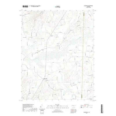
2019 Map of Palmersville
USGS Topo · Published 2019About this map
The Palmersville community serves as the central hub of this rural Weakley County landscape, situated near the headwaters of the North Fork Obion River. This environment is defined by its agricultural character and the extensive wetlands of Bumpas Bottom and the surrounding river flats. The mapping details an intricate network of country roads, several of which follow flood-control structures like Donoho Levee Rd and Powell Levee Rd, indicating the historical significance of water management in this bottomland region.
Find a feature on this map
91 named features on this map. Tap any name to fly to it.
Don’t see what you’re looking for? This feature index may not catch every label — zoom into the map to look around manually.
Map Details
Editions of this 2019 Palmersville Map
This is the sole edition of this map. No revisions or reprints were ever made.
Other maps of this area

1936 · Crossland
USGS Topo · 1:24,000

1936 · Lynn Grove
USGS Topo · 1:24,000

1950 · Osage
USGS Topo · 1:24,000

1950 · Cottage Grove
USGS Topo · 1:24,000
1951 · Murray
USGS Topo · 1:62,500
1951 · Lynn Grove
USGS Topo · 1:24,000

1952 · Dresden
USGS Topo · 1:24,000

1952 · Cuba
USGS Topo · 1:24,000

1952 · Mayfield
USGS Topo · 1:62,500
1952 · Lynnville
USGS Topo · 1:24,000