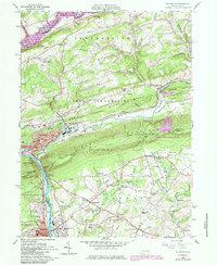
1960 Map of Palmerton
USGS Topo · Published 1984About this map
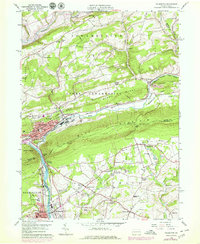
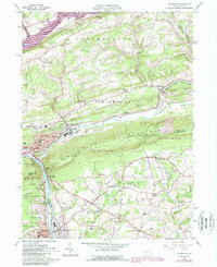
Palmerton dominates the river landscape where the Lehigh River cuts through the formidable barrier of Blue Mountain at Lehigh Gap. This 1960s-era geography shows a dense industrial and residential corridor defined by the Conrail line and the historic Lehigh Canal. While the borough of Palmerton is the primary urban center, the surrounding rural townships of Towamensing and Lower Towamensing are dotted with smaller settlements like Aquashicola and Little Gap. The map captures a moment when mid-century leisure features, such as the Drive-in Theater near Berlinsville and the Slatington Airport, shared the land with traditional extractive industries, evidenced by numerous Quarries and Gravel Pits. Outdoor recreation is well-established, with the Appalachian Trail following the ridge lines and the northern boundary touching Beltzville State Park along Pohopoco Creek.
Find a feature on this map
78 named features on this map. Tap any name to fly to it.
Don’t see what you’re looking for? This feature index may not catch every label — zoom into the map to look around manually.
Map Details
Editions of this 1960 Palmerton Map
6 editions found
Other maps of this area

1894 · Allentown
USGS Topo · 1:62,500

1902 · Slatington
USGS Topo · 1:62,500

1914 · Wind Gap
USGS Topo · 1:62,500

1916 · Wind Gap
USGS Topo · 1:62,500

1922 · Mauch Chunk
USGS Topo · 1:62,500

1924 · Mauch Chunk
USGS Topo · 1:62,500

1937 · Allentown West
USGS Topo · 1:48,000

1939 · Allentown
USGS Topo · 1:62,500

1942 · Allentown West
USGS Topo · 1:62,500

1943 · Mauch Chunk
USGS Topo · 1:62,500