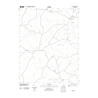
2010 Map of Palmyra
USGS Topo · Published 2010About this map
The Rivanna River carves through this Fluvanna County landscape, passing the community of Palmyra and the historic Pembroke Petit Bridge. In the early 21st century, the area maintains its rural character through established settlements like Kidds Store, Central Plains, and Cunningham. The terrain is defined by the drainage of numerous creek systems, including Bremo Creek and the South Fork Cunningham Creek, which flow around local elevations such as Mountain Hill and Little Mountain Hill. In the southeastern corner, the road network converges at Fork Union and Weber City, illustrating a settlement pattern shaped by the intersection of traditional crossroads and watercourses. Genealogists and local historians can trace family-named roads like Rhodes School Ln and Wagner Pl that link these small communities together.
Find a feature on this map
37 named features on this map. Tap any name to fly to it.
Don’t see what you’re looking for? This feature index may not catch every label — zoom into the map to look around manually.
Map Details
Editions of this 2010 Palmyra Map
This is the sole edition of this map. No revisions or reprints were ever made.
Other maps of this area

1891 · Palmyra
USGS Topo · 1:125,000

1895 · Palmyra
USGS Topo · 1:125,000

1897 · Palmyra
USGS Topo · 1:125,000

1943 · Scottsville
USGS Topo · 1:62,500

1946 · Scottsville
USGS Topo · 1:62,500

1947 · Roanoke
USGS Topo · 1:250,000

1950 · Dillwyn
USGS Topo · 1:62,500

1958 · Dillwyn
USGS Topo · 1:62,500

1959 · Roanoke
USGS Topo · 1:250,000

1960 · Columbia
USGS Topo · 1:62,500