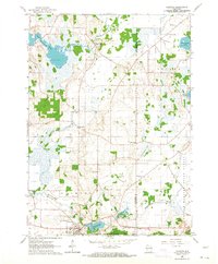
1960 Map of Palmyra
USGS Topo · Published 1964About this map
Glacial topography and the varied wetland ecosystems of the Kettle Moraine dominate this 1960s study of southeastern Wisconsin. The village of Palmyra serves as a hub, situated near the Scuppernong River and the expanding borders of the Kettle Moraine State Forest. The map captures a transition in land use, from the rural character of settlements like Heath Mills and Oak Hill to the infrastructure of the Palmyra Airport and a municipal Sewage Disposal plant.
Find a feature on this map
30 named features on this map. Tap any name to fly to it.
Don’t see what you’re looking for? This feature index may not catch every label — zoom into the map to look around manually.
Map Details
Editions of this 1960 Palmyra Map
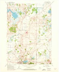
2 editions found
Other maps of this area

1892 · Watertown
USGS Topo · 1:62,500

1892 · Oconomowoc
USGS Topo · 1:62,500

1892 · Whitewater
USGS Topo · 1:62,500

1892 · Eagle
USGS Topo · 1:62,500

1893 · Whitewater
USGS Topo · 1:62,500

1894 · Watertown
USGS Topo · 1:62,500

1894 · Eagle
USGS Topo · 1:62,500

1897 · Eagle
USGS Topo · 1:62,500

1903 · Whitewater
USGS Topo · 1:62,500

1906 · Eagle
USGS Topo · 1:62,500