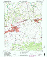
1969 Map of Palmyra
USGS Topo · Published 1990About this map
Palmyra and Annville anchor this 1969 Lebanon County survey, showing the corridor's development as it appeared before late-century suburban expansion. The historic Union Canal traces a path along the Swatara Creek to the north, a remnant of earlier transportation networks that once defined the region. The map captures the institutional core of the area, including Lebanon Valley College and several local schools like Forge Street Sch and Annville-Cleona High Sch. In addition to the larger towns, smaller rural settlements such as Bellegrove, Steelstown, and Campbelltown are documented alongside numerous quarries that speak to the local geology and industry. Genealogists will find significant value in the detailed plotting of local landmarks like the Gravel Hill Cemetery, Mount Annville Cem, and Dohners Ch Cem, which help locate long-standing community centers.
Find a feature on this map
57 named features on this map. Tap any name to fly to it.
Don’t see what you’re looking for? This feature index may not catch every label — zoom into the map to look around manually.
Map Details
Editions of this 1969 Palmyra Map
4 editions found
Other maps of this area

1891 · Lebanon
USGS Topo · 1:62,500

1892 · Hummelstown
USGS Topo · 1:62,500

1893 · Lebanon
USGS Topo · 1:62,500

1899 · Lebanon
USGS Topo · 1:62,500

1902 · Lancaster
USGS Topo · 1:62,500

1904 · Lancaster
USGS Topo · 1:62,500

1908 · Middletown
USGS Topo · 1:62,500

1924 · Hummelstown
USGS Topo · 1:62,500

1943 · Lancaster
USGS Topo · 1:62,500

1943 · Lebanon
USGS Topo · 1:62,500
Featured Places
- Hershey, Derry Township
- Palmyra, PA
- Campbelltown, South Londonderry Township
- Annville, PA
- East Hanover Township, PA