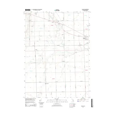
2014 Map of Palmyra
USGS Topo · Published 2014About this map
The River Raisin meanders through this portion of Lenawee County, defining the agricultural and settlement patterns of Blissfield and Palmyra. The landscape is etched with an extensive network of drainage infrastructure, including the Colvin-Drain, Pease Drain, and Big Meadow Drain, which converted the natural marshlands into productive Michigan farmland.
Find a feature on this map
80 named features on this map. Tap any name to fly to it.
Don’t see what you’re looking for? This feature index may not catch every label — zoom into the map to look around manually.
Map Details
Editions of this 2014 Palmyra Map
This is the sole edition of this map. No revisions or reprints were ever made.
Other maps of this area

1911 · Wauseon
USGS Topo · 1:62,500

1911 · Swanton
USGS Topo · 1:62,500

1913 · Wauseon
USGS Topo · 1:62,500

1914 · Swanton
USGS Topo · 1:62,500

1935 · Berkey
USGS Topo · 1:24,000

1939 · Berkey
USGS Topo · 1:31,680

1939 · Blissfield
USGS Topo · 1:62,500

1941 · Blissfield
USGS Topo · 1:62,500

1943 · Wauseon
USGS Topo · 1:62,500
1951 · Berkey
USGS Topo · 1:24,000