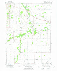
1972 Map of Palmyra
USGS Topo · Published 1975About this map
The Raisin River carves a winding path through this corner of Lenawee County, defining the agricultural landscape between the townships of Palmyra and Ogden. Small rural centers such as Palmyra and Ogden Center serve as the primary hubs, connected by a rigid grid of country roads including Adrian Road and Ridgeville Road. The area's transport legacy is evident in the rail lines that cross the terrain, specifically the Penn Central and the Detroit and Ironton routes, which facilitated the movement of goods from the surrounding fields.
Find a feature on this map
46 named features on this map. Tap any name to fly to it.
Don’t see what you’re looking for? This feature index may not catch every label — zoom into the map to look around manually.
Map Details
Editions of this 1972 Palmyra Map
This is the sole edition of this map. No revisions or reprints were ever made.
Other maps of this area

1911 · Wauseon
USGS Topo · 1:62,500

1911 · Swanton
USGS Topo · 1:62,500

1913 · Wauseon
USGS Topo · 1:62,500

1914 · Swanton
USGS Topo · 1:62,500

1935 · Berkey
USGS Topo · 1:24,000

1939 · Berkey
USGS Topo · 1:31,680

1939 · Blissfield
USGS Topo · 1:62,500

1941 · Blissfield
USGS Topo · 1:62,500

1943 · Wauseon
USGS Topo · 1:62,500
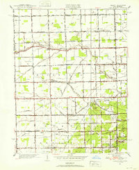
1951 · Berkey
USGS Topo · 1:24,000