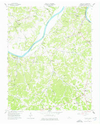
1958 Map of Palmyra
USGS Topo · Published 1976About this map
The Cumberland River bisects this mid-century landscape of Montgomery County, where the river-driven economy is evidenced by the riverfront settlement at Palmyra and the small station at Hematite. To the south, the Louisville and Nashville Railroad parallels the river, providing a critical transport link for rural communities. The map is particularly rich in genealogical data, recording numerous family-named burial grounds such as Wickham Cem and Baggett Cem, along with community anchors like Haynes Chapel and Central High Sch. The topography is defined by intricate drainage patterns, including Antioch Creek and Budds Creek, which carve through the plateau towards the main river channel. From the Lookout Tower near the southern border to the Indian Mound in the north, the terrain reflects a mix of natural landmarks and deep-seated human habitation, captured just as the local road network, including the Clarksville-Waverly Road, was formalizing around older tracks.
Find a feature on this map
56 named features on this map. Tap any name to fly to it.
Don’t see what you’re looking for? This feature index may not catch every label — zoom into the map to look around manually.
Map Details
Editions of this 1958 Palmyra Map
4 editions found
Other maps of this area

1931 · Erin
USGS Topo · 1:62,500

1944 · Clarksville
USGS Topo · 1:50,000

1951 · New Providence
USGS Topo · 1:24,000

1951 · Clarksville
USGS Topo · 1:24,000

1951 · Woodlawn
USGS Topo · 1:24,000

1956 · Nashville
USGS Topo · 1:250,000

1957 · New Providence
USGS Topo · 1:24,000

1957 · Clarksville
USGS Topo · 1:24,000
1957 · Woodlawn
USGS Topo · 1:24,000
1957 · Clarksville
USGS Topo · 1:62,500