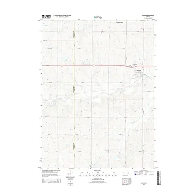
2014 Map of Palmyra
USGS Topo · Published 2014About this map
The Little Nemaha River winds through this agricultural landscape on the border of Lancaster and Otoe Counties, shaping the development of Palmyra in the northeastern corner of the map. This 2014 survey captures a rural environment where modern residential developments like Woodland Hills contrast with established farmstead grids and local cemeteries. Genealogists and local historians can find several important burial sites, including Rosewood Cem and Saint Leos Cem near the town center, as well as the more isolated Mt Zion Cem to the south. The terrain is defined by a series of drainage systems, including Hooper Cr and Silver Cr, which flow toward the river. To the southwest, the Mueller Reservoir serves as a notable hydrologic feature amidst an extensive network of rural roads such as Wittstruck Rd and Roca Rd that follow the section lines of the Nebraska prairie.
Find a feature on this map
46 named features on this map. Tap any name to fly to it.
Don’t see what you’re looking for? This feature index may not catch every label — zoom into the map to look around manually.
Map Details
Editions of this 2014 Palmyra Map
This is the sole edition of this map. No revisions or reprints were ever made.
Other maps of this area

1897 · Lincoln
USGS Topo · 1:125,000

1903 · Weeping Water
USGS Topo · 1:125,000

1929 · Weeping Water
USGS Topo · 1:125,000

1955 · Lincoln
USGS Topo · 1:250,000

1957 · Lincoln
USGS Topo · 1:250,000

1958 · Lincoln
USGS Topo · 1:250,000

1964 · Walton
USGS Topo · 1:24,000
1965 · Firth
USGS Topo · 1:24,000
1965 · Douglas
USGS Topo · 1:24,000
1966 · Bennet
USGS Topo · 1:24,000