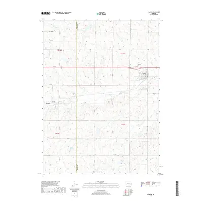
2017 Map of Palmyra
USGS Topo · Published 2017About this map
Palmyra and Bennet anchor this agricultural landscape along the boundary of Lancaster Co and Otoe Co in southeastern Nebraska. The terrain is defined by the winding course of the Little Nemaha River, which is fed by several local drainages including Silver Cr, Hooper Cr, and Russell Cr. This section of the Great Plains maintains a strict grid of section roads like Rokeby Rd and Saltillo Rd, occasionally interrupted by natural features or the small-town street plans of the primary settlements.
Find a feature on this map
49 named features on this map. Tap any name to fly to it.
Don’t see what you’re looking for? This feature index may not catch every label — zoom into the map to look around manually.
Map Details
Editions of this 2017 Palmyra Map
This is the sole edition of this map. No revisions or reprints were ever made.
Other maps of this area

1897 · Lincoln
USGS Topo · 1:125,000

1903 · Weeping Water
USGS Topo · 1:125,000

1929 · Weeping Water
USGS Topo · 1:125,000

1955 · Lincoln
USGS Topo · 1:250,000

1957 · Lincoln
USGS Topo · 1:250,000

1958 · Lincoln
USGS Topo · 1:250,000

1964 · Walton
USGS Topo · 1:24,000
1965 · Firth
USGS Topo · 1:24,000
1965 · Douglas
USGS Topo · 1:24,000
1966 · Bennet
USGS Topo · 1:24,000