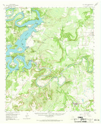
1958 Map of Palo Pinto
USGS Topo · Published 1969About this map
Possum Kingdom Lake dominates this mid-century landscape, held back by the Morris Sheppard Dam. The reservoir creates a complex shoreline of deep bays and sharp points, including Hells Gate and the waters surrounding Costello Island. Beyond the lake, the Brazos River continues its winding course through a series of dramatic loops, notably Fortune Bend and Dalton Bend.
Find a feature on this map
76 named features on this map. Tap any name to fly to it.
Don’t see what you’re looking for? This feature index may not catch every label — zoom into the map to look around manually.
Map Details
Editions of this 1958 Palo Pinto Map
2 editions found

Other maps of this area

1890 · Breckenridge
USGS Topo · 1:125,000

1891 · Palo Pinto
USGS Topo · 1:125,000

1918 · Palo Pinto
USGS Topo · 1:125,000

1924 · Breckenridge 1-a
USGS Topo · 1:48,000

1924 · Palo Pinto 2-b
USGS Topo · 1:48,000

1924 · Palo Pinto 2-a
USGS Topo · 1:48,000

1924 · Palo Pinto 1-b
USGS Topo · 1:48,000

1924 · Graham 4-d
USGS Topo · 1:48,000

1924 · Palo Pinto 2-c
USGS Topo · 1:48,000

1924 · Breckenridge 1-d
USGS Topo · 1:48,000