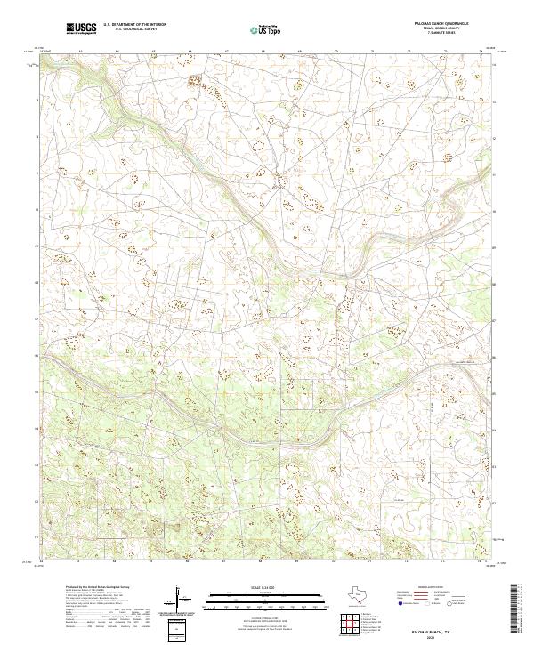
2022 Map of Palomas Ranch
USGS Topo · Published 2022About this map
Palo Blanco Cr and Arroyo Baluarte define the drainage patterns of this South Texas landscape in Brooks County. The terrain is characterized by the ephemeral flow of these creek systems, which cut through the ranchlands that dominate the area. Human activity is primarily visible through a sparse network of county roads, including Co Rd 110 and Co Rd 101, which navigate the open country. The naming of Baluarte Creek Rd reflects the local importance of the arroyo to the few transit routes established here. This 2022 survey captures the modern ranch boundaries and infrastructure, showing how water sources dictate the placement of roads and homesteads in a region where every creek bed is a significant landmark.
Find a feature on this map
6 named features on this map. Tap any name to fly to it.
Don’t see what you’re looking for? This feature index may not catch every label — zoom into the map to look around manually.
Map Details
Editions of this 2022 Palomas Ranch Map
This is the sole edition of this map. No revisions or reprints were ever made.
Other maps of this area

1921 · Falfurrias
USGS Topo · 1:125,000

1956 · Laredo
USGS Topo · 1:250,000

1963 · Premont West
USGS Topo · 1:24,000

1963 · Cage Ranch
USGS Topo · 1:24,000

1963 · Falfurrias
USGS Topo · 1:24,000

1968 · Palomas Ranch NW
USGS Topo · 1:24,000

1968 · Palomas Ranch SW
USGS Topo · 1:24,000

1968 · Palomas Ranch SE
USGS Topo · 1:24,000

1968 · Palomas Ranch
USGS Topo · 1:24,000
1969 · Laguna Del Toro
USGS Topo · 1:24,000