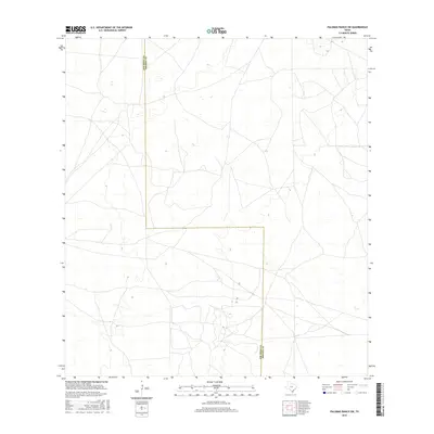
2016 Map of Palomas Ranch SW
USGS Topo · Published 2016About this map
The county line between Jim Hogg Co and Brooks Co runs vertically through this rural section of South Texas, defining the administrative geography of a vast, unpopulated landscape. The map reveals an intricate network of local roads and 4WD tracks that traverse the area, illustrating the essential infrastructure required for ranching and land management in this part of the state. With no named towns or settlements printed on the sheet, the focus remains entirely on the natural topography and the surveyed boundaries that segment the brush country during the early twenty-first century.
Find a feature on this map
1 named feature on this map. Tap any name to fly to it.
Don’t see what you’re looking for? This feature index may not catch every label — zoom into the map to look around manually.
Map Details
Editions of this 2016 Palomas Ranch SW Map
This is the sole edition of this map. No revisions or reprints were ever made.
Other maps of this area

1921 · Falfurrias
USGS Topo · 1:125,000

1938 · Agua Nueva
USGS Topo · 1:62,500

1939 · Encantada
USGS Topo · 1:62,500

1949 · Mc Allen
USGS Topo · 1:250,000

1954 · McAllen
USGS Topo · 1:250,000

1956 · Laredo
USGS Topo · 1:250,000

1957 · Mc Allen
USGS Topo · 1:250,000

1962 · McAllen
USGS Topo · 1:250,000

1968 · Palomas Ranch NW
USGS Topo · 1:24,000

1968 · Palomas Ranch SW
USGS Topo · 1:24,000