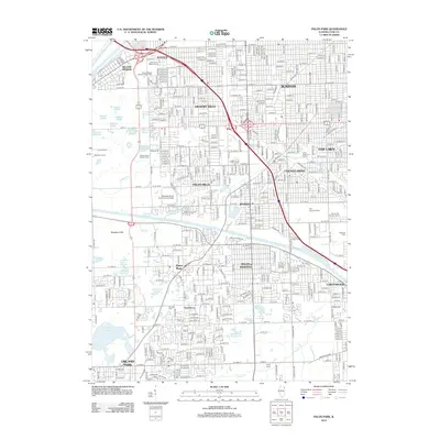
2012 Map of Palos Park
USGS Topo · Published 2012About this map
The Calumet Sag Channel anchors this suburban Cook County landscape, cutting a straight line through a dense network of residential streets and natural preserves. The area is characterized by an extensive system of sloughs and lakes, particularly in the west where McGinnis Slough and Swallow Cliffs offer a sharp contrast to the nearby developed corridors of Hickory Hills and Oak Lawn.
Find a feature on this map
71 named features on this map. Tap any name to fly to it.
Don’t see what you’re looking for? This feature index may not catch every label — zoom into the map to look around manually.
Map Details
Editions of this 2012 Palos Park Map
This is the sole edition of this map. No revisions or reprints were ever made.
Other maps of this area

1889 · Chicago
USGS Topo · 1:62,500

1890 · Des Plaines
USGS Topo · 1:62,500

1891 · Chicago
USGS Topo · 1:62,500

1891 · Riverside
USGS Topo · 1:62,500

1892 · Calumet
USGS Topo · 1:62,500

1893 · Calumet
USGS Topo · 1:62,500

1893 · Riverside
USGS Topo · 1:62,500

1894 · Des Plaines
USGS Topo · 1:62,500

1900 · Chicago
USGS Topo · 1:62,500

1900 · Des Plaines
USGS Topo · 1:62,500