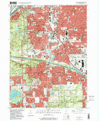
1997 Map of Palos Park
USGS Topo · Published 1999About this map
The Calumet Sag Channel and the Chicago Sanitary and Ship Canal define the industrial and hydrological character of this portion of Cook County, cutting through a landscape where dense urban expansion meets preserved woodlands. Large institutional grounds dominate the terrain, notably the massive Resurrection Cemetery and Holy Sepulchre Cemetery, which serve as significant landmarks for genealogists alongside the smaller, secluded Bachelor Grove Cem.
Find a feature on this map
137 named features on this map. Tap any name to fly to it.
Don’t see what you’re looking for? This feature index may not catch every label — zoom into the map to look around manually.
Map Details
Editions of this 1997 Palos Park Map
This is the sole edition of this map. No revisions or reprints were ever made.
Other maps of this area

1889 · Chicago
USGS Topo · 1:62,500

1890 · Des Plaines
USGS Topo · 1:62,500

1891 · Chicago
USGS Topo · 1:62,500

1891 · Riverside
USGS Topo · 1:62,500

1892 · Calumet
USGS Topo · 1:62,500

1893 · Calumet
USGS Topo · 1:62,500

1893 · Riverside
USGS Topo · 1:62,500

1894 · Des Plaines
USGS Topo · 1:62,500

1900 · Chicago
USGS Topo · 1:62,500

1900 · Des Plaines
USGS Topo · 1:62,500