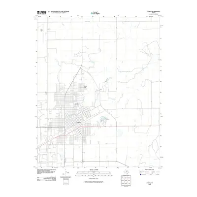
2010 Map of Pampa
USGS Topo · Published 2010About this map
Pampa serves as the primary urban center in this Gray County landscape, where the street grid is interrupted by the winding path of Red Deer Creek. The city's residential expansion is visible in neighborhoods like Mesilla Park and along major thoroughfares such as State Loop 171. Public and recreational infrastructure is concentrated around the City of Pampa Lake, which is held by the City of Pampa Lake Dam. This 2010 survey illustrates the community's established history through its local burial grounds, including Fairview Cemetery and Memory Garden. Beyond the city limits, the terrain transitions into the vast agricultural and ranching sections of the Texas Panhandle, evidenced by an extensive network of rural roads like County Line Rd and aviation facilities at Perry Lefors Field.
Find a feature on this map
30 named features on this map. Tap any name to fly to it.
Don’t see what you’re looking for? This feature index may not catch every label — zoom into the map to look around manually.
Map Details
Editions of this 2010 Pampa Map
This is the sole edition of this map. No revisions or reprints were ever made.
Other maps of this area

1954 · Amarillo
USGS Topo · 1:250,000

1958 · Amarillo
USGS Topo · 1:250,000

1963 · Pampa
USGS Topo · 1:24,000

1965 · Lake Mc Connell
USGS Topo · 1:24,000

1966 · Kingsmill
USGS Topo · 1:24,000

1966 · Bowers City
USGS Topo · 1:24,000

1967 · Lefors
USGS Topo · 1:24,000

1967 · Hoover
USGS Topo · 1:24,000

1971 · Skellytown NE
USGS Topo · 1:24,000

1971 · Pampa NW
USGS Topo · 1:24,000