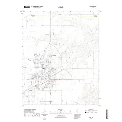
2019 Map of Pampa
USGS Topo · Published 2019About this map
The industrial and residential grid of Pampa dominates the high plains landscape of the Texas Panhandle in this contemporary survey. As the county seat of Gray County, the city shows a dense network of streets and neighborhoods like Mesilla Park, structured around major thoroughfares such as Harvester Ave and Alcock St. The urban landscape is punctuated by essential community landmarks, including Fairview Cem and Memory Gardens of Pampa, reflecting the city's long-term settlement. To the northwest, the aviation footprint of Perry Lefors Field sits near the border of Roberts Co. The natural hydrology of the region is represented by the meandering Red Deer Cr and the reservoir at City of Pampa Lake, which offer a stark contrast to the precise geometry of the surrounding section roads like Co Line Rd and Walnut Creek Rd.
Find a feature on this map
90 named features on this map. Tap any name to fly to it.
Don’t see what you’re looking for? This feature index may not catch every label — zoom into the map to look around manually.
Map Details
Editions of this 2019 Pampa Map
This is the sole edition of this map. No revisions or reprints were ever made.
Other maps of this area

1954 · Amarillo
USGS Topo · 1:250,000

1958 · Amarillo
USGS Topo · 1:250,000

1963 · Pampa
USGS Topo · 1:24,000

1965 · Lake Mc Connell
USGS Topo · 1:24,000

1966 · Kingsmill
USGS Topo · 1:24,000

1966 · Bowers City
USGS Topo · 1:24,000

1967 · Lefors
USGS Topo · 1:24,000

1967 · Hoover
USGS Topo · 1:24,000

1971 · Skellytown NE
USGS Topo · 1:24,000

1971 · Pampa NW
USGS Topo · 1:24,000