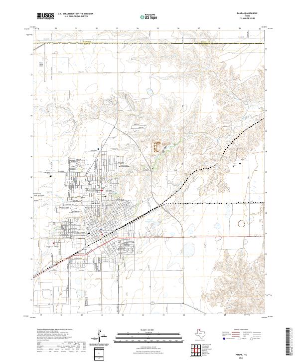
2022 Map of Pampa
USGS Topo · Published 2022About this map
Pampa serves as a critical hub in the Texas Panhandle, where the city's grid-patterned growth reflects its role as the seat of Gray County. The map details the urban core, anchored by the Gray County Courthouse and the academic presence of the Clarendon College Pampa Center. Residential expansion is visible toward Mesilla Park, while the local history of the community is preserved at Fairview Cem and the Saint Matthews Episcopal Church Columbarium. The landscape is defined by the winding course of Red Deer Cr, which cuts through the northern plains toward the City of Pampa Lake. Transportation is a dominant theme, with the city situated at the junction of regional routes like Ranch Rd 282 and Ranch Rd 749, supporting the local economy and the operations at Perry Lefors Field to the northwest.
Find a feature on this map
23 named features on this map. Tap any name to fly to it.
Don’t see what you’re looking for? This feature index may not catch every label — zoom into the map to look around manually.
Map Details
Editions of this 2022 Pampa Map
This is the sole edition of this map. No revisions or reprints were ever made.
Other maps of this area

1954 · Amarillo
USGS Topo · 1:250,000

1958 · Amarillo
USGS Topo · 1:250,000

1963 · Pampa
USGS Topo · 1:24,000

1965 · Lake Mc Connell
USGS Topo · 1:24,000

1966 · Kingsmill
USGS Topo · 1:24,000

1966 · Bowers City
USGS Topo · 1:24,000

1967 · Lefors
USGS Topo · 1:24,000

1967 · Hoover
USGS Topo · 1:24,000

1971 · Skellytown NE
USGS Topo · 1:24,000

1971 · Pampa NW
USGS Topo · 1:24,000