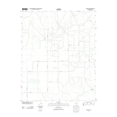
2012 Map of Pampa NE
USGS Topo · Published 2012About this map
Codman sits in the southeast corner of this Texas Panhandle landscape, where the energy industry and cattle ranching shape the terrain. The infrastructure of the Quinpono Gas and Oil Field is central to the area's modern economy, reflected in a dense network of local routes like Haggard Rd and Nelson Rd. Natural drainage patterns are defined by the winding paths of Red Deer Cr, Bluff Cr, and Indian Cr, which cut through the high plains. Large-scale land use is evident in the naming of extensive corridors such as Turkey Track Rd and Broaddus Rd, pointing to the region's history of significant ranch holdings. These arterial roads, including Ranch Road 282, provide the primary connectivity between isolated operations and the small settlement at Codman.
Find a feature on this map
21 named features on this map. Tap any name to fly to it.
Don’t see what you’re looking for? This feature index may not catch every label — zoom into the map to look around manually.
Map Details
Editions of this 2012 Pampa NE Map
This is the sole edition of this map. No revisions or reprints were ever made.
Other maps of this area

1954 · Amarillo
USGS Topo · 1:250,000

1958 · Amarillo
USGS Topo · 1:250,000

1963 · Pampa
USGS Topo · 1:24,000

1966 · Laketon
USGS Topo · 1:24,000

1967 · Hoover
USGS Topo · 1:24,000

1971 · Dry Creek South
USGS Topo · 1:24,000

1971 · Dry Creek SE
USGS Topo · 1:24,000

1971 · Pampa NW
USGS Topo · 1:24,000

1972 · Pampa NE
USGS Topo · 1:24,000

1972 · Miami
USGS Topo · 1:24,000