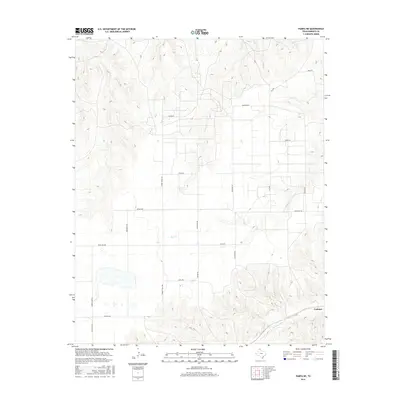
2016 Map of Pampa NE
USGS Topo · Published 2016About this map
Codman sits in the southeastern corner of this Roberts County landscape, marking a quiet point of human settlement amidst the drainage systems of the Texas Panhandle. The topography is defined by the carved paths of Indian Cr in the north and the winding course of Red-Deer Cr to the south, which cuts through the rising terrain of the eastern plains. Between these watercourses, a rigid grid of ranch and county roads reveals the organized land divisions typical of the region's agricultural and pastoral heritage. Prominent thoroughfares like Turkey Track Rd and Ranch Rd 282 provide the primary framework for local travel, while smaller routes like Maddox Rd and Green Lake Rd offer access to the more isolated reaches of the high plains. This 2016 survey illustrates how modern infrastructure remains tethered to the natural draws of Bluff Cr and other seasonal drainage features.
Find a feature on this map
20 named features on this map. Tap any name to fly to it.
Don’t see what you’re looking for? This feature index may not catch every label — zoom into the map to look around manually.
Map Details
Editions of this 2016 Pampa NE Map
This is the sole edition of this map. No revisions or reprints were ever made.
Other maps of this area

1954 · Amarillo
USGS Topo · 1:250,000

1958 · Amarillo
USGS Topo · 1:250,000

1963 · Pampa
USGS Topo · 1:24,000

1966 · Laketon
USGS Topo · 1:24,000

1967 · Hoover
USGS Topo · 1:24,000

1971 · Dry Creek South
USGS Topo · 1:24,000

1971 · Dry Creek SE
USGS Topo · 1:24,000

1971 · Pampa NW
USGS Topo · 1:24,000

1972 · Pampa NE
USGS Topo · 1:24,000

1972 · Miami
USGS Topo · 1:24,000